
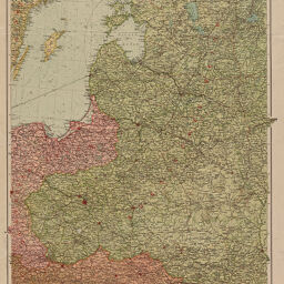
Deutsch-russische Grenzlande
Karte der deutsch-russischen Grenzlande
Permalink
https://digital.library.illinois.edu/items/f06405f0-17c7-0137-6b56-02d0d7bfd6e4-b
No Copyright - United States
Descriptive Information
| Title | Deutsch-russische Grenzlande |
| Alternative Title | Karte der deutsch-russischen Grenzlande |
| Creator | Velhagen & Klasing (Firm) |
| Scale | Scale 1:2,000,000. 1 mm auf der Karte = 2 km in der Natur. |
| Coordinates | (E 15°30'--E 32°50'/N 61°00'--N 47°20') |
| Place of Publication |
|
| Publisher | Velhagen & Klasing (Firm) |
| Date of Publication | 1914-1917 |
| Extent | 1 map, color |
| Dimensions | 75 x 52 cm, folded to 21 x 14 cm |
| Notes |
|
| Coverage-Spatial | |
| Language | German |
| Genre | Maps |
| Rights Description | No Copyright - United States |
| Type | Cartographic material |
| Repository | Map Library |
| Local Bib ID | 7669717 |
| Collection Title | World War I Maps |
| Collection | World War I Maps |
Download Options
|
Deutsch-russische Grenzlande |
Contact us
for questions and to provide feedback.