
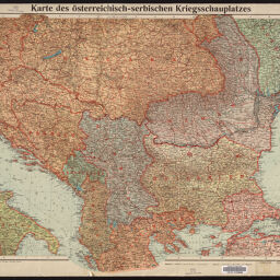
Karte des österreichisch-serbischen Kriegsschauplatzes
Permalink
https://digital.library.illinois.edu/items/f07a11e0-17c7-0137-6b56-02d0d7bfd6e4-5
No Copyright - United States
Descriptive Information
| Title | Karte des österreichisch-serbischen Kriegsschauplatzes |
| Creator | Velhagen & Klasing (Firm) |
| Scale | Scale 1:2,000,000. 1 mm auf der Karte = 2 km in der Natur |
| Coordinates | (E 14°00ʹ--E 31°00ʹ/N 48°20ʹ--N 39°00ʹ) |
| Place of Publication |
|
| Publisher | Velhagen & Klasing (Firm) |
| Date of Publication | 1914 |
| Extent | 1 map, color |
| Dimensions | 51 x 61 cm |
| Notes |
|
| Coverage-Spatial | |
| Language | German |
| Genre | Maps |
| Rights Description | No Copyright - United States |
| Type | Cartographic material |
| Repository | Map Library |
| Local Bib ID | 7674614 |
| Collection Title | World War I Maps |
| Collection | World War I Maps |
Download Options
|
Karte des österreichisch-serbischen Kriegsschauplatzes |
Contact us
for questions and to provide feedback.