
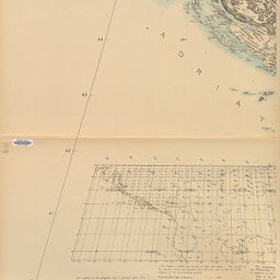
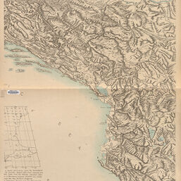
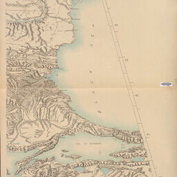
Block diagram showing terrain of the Balkan Peninsula
Permalink
https://digital.library.illinois.edu/items/f0822ab0-17c7-0137-6b56-02d0d7bfd6e4-4
No Copyright - United States
Descriptive Information
| Title | Block diagram showing terrain of the Balkan Peninsula |
| Creator | American Geographical Society of New York |
| Scale | Scale approximately 1:600,000 |
| Coordinates | (E 12°50'--E 30°00'/N 46°00'--N 39°00') |
| Place of Publication | New York (N.Y.) |
| Publisher | American Geographical Society of New York |
| Date of Publication | 1918 |
| Extent | 1 map on 4 sheets |
| Dimensions | 105 x 272 cm, on sheets 122 x 76 cm |
| Notes |
|
| Coverage-Spatial | Balkan Peninsula |
| Language | English |
| Genre | |
| Rights Description | No Copyright - United States |
| Type | Cartographic material |
| Repository | Map Library |
| Local Bib ID | 7676766 |
| Collection Title | World War I Maps |
| Collection | World War I Maps |
Download Options
|
7676766-001 | |
|
7676766-002 | |

|
7676766-003 | |
|
7676766-004 |
Contact us
for questions and to provide feedback.