
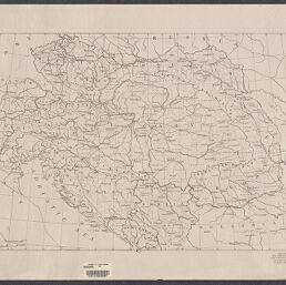
Map of the Austro-Hungarian Empire, the northern Balkan Peninsula, and Romania
Permalink
https://digital.library.illinois.edu/items/f0973570-17c7-0137-6b56-02d0d7bfd6e4-7
No Copyright - United States
Descriptive Information
| Title | Map of the Austro-Hungarian Empire, the northern Balkan Peninsula, and Romania |
| Creator | American Geographical Society of New York |
| Scale | Scale approximately 1:2,587,500 |
| Coordinates | (E 8°00'--E 31°10'/N 51°15'--N 41°40') |
| Place of Publication | New York (N.Y.) |
| Publisher | American Geographical Society of New York |
| Date of Publication | 1914-1919 |
| Extent | 1 map |
| Dimensions | 39 x 64 cm |
| Notes |
|
| Coverage-Spatial | |
| Language | English |
| Genre | Maps |
| Rights Description | No Copyright - United States |
| Type | Cartographic material |
| Repository | Map Library |
| Local Bib ID | 7678022 |
| Collection Title | World War I Maps |
| Collection | World War I Maps |
Download Options
|
Map of the Austro-Hungarian Empire, the northern Balkan Peninsula, and Romania |
Contact us
for questions and to provide feedback.