
Rand, McNally & Co.'s indexed atlas of the World map of Asia
Asia
Permalink
https://digital.library.illinois.edu/items/f0a1e9d0-17c7-0137-6b56-02d0d7bfd6e4-8
No Copyright - United States
Descriptive Information
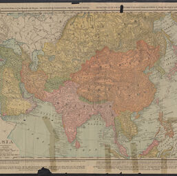
| Title | Rand, McNally & Co.'s indexed atlas of the World map of Asia |
| Alternative Title |
|
| Creator | Rand McNally and Company |
| Scale | Scale 1:15,840,000. Statute miles, 250 = 1 in. Km, 402 = 1 in. |
| Coordinates | (E 10°--E 17°/N 75°--S 5°) |
| Place of Publication | Chicago (Ill.) |
| Publisher | Rand McNally and Company |
| Date of Publication | 1900 |
| Extent | 1 map, color |
| Dimensions | 48 x 65 cm, on sheet 56 x 79 cm |
| Notes |
|
| Coverage-Spatial | Asia |
| Language | English |
| Genre | Maps |
| Rights Description | No Copyright - United States |
| Type | Cartographic material |
| Repository | Map Library |
| Local Bib ID | 7678954 |
| Collection Title | World War I Maps |
| Collection | World War I Maps |
Download Options
|
Rand, McNally & Co.'s indexed atlas of the World map of Asia |
Contact us
for questions and to provide feedback.