
Carte-guide Campbell
Italia (Trentino, Tirolo, Venetia)
Permalink
https://digital.library.illinois.edu/items/f0d54530-17c7-0137-6b56-02d0d7bfd6e4-a
No Copyright - United States
Descriptive Information
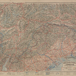
| Title | Carte-guide Campbell |
| Alternative Title | Italia (Trentino, Tirolo, Venetia) |
| Creator | Editions Blondel La Rougery |
| Scale | Scale 1:320,000 |
| Coordinates | (E 9°50'--E 14°00'/N 47°17'--N 45°19') |
| Place of Publication | Paris (France) |
| Publisher | Éditions Blondel La Rougery |
| Date of Publication | 1917 |
| Extent | 1 map, color |
| Dimensions | 66 x 98 cm |
| Notes |
|
| Coverage-Spatial | |
| Language | Italian |
| Genre | Thematic maps |
| Rights Description | No Copyright - United States |
| Type | Cartographic material |
| Repository | Map Library |
| Local Bib ID | 7680612 |
| Collection Title | World War I Maps |
| Collection | World War I Maps |
Download Options
|
Carte-guide Campbell |
Contact us
for questions and to provide feedback.