


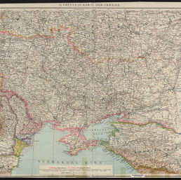
G. Freytags Karte der Ukraina
G. Freytag's Karte der Ukraina
Permalink
https://digital.library.illinois.edu/items/f0dccd80-17c7-0137-6b56-02d0d7bfd6e4-d
No Copyright - United States
Descriptive Information
| Title | G. Freytags Karte der Ukraina |
| Alternative Title | G. Freytag's Karte der Ukraina |
| Creator | Freytag und Berndt |
| Scale | Scale 1:2,000,000 |
| Coordinates | (E 21°--E 51°/N 55°--N 42°) |
| Place of Publication | Vienna (Austria) |
| Publisher | Freytag und Berndt |
| Date of Publication | 1918 |
| Extent | 1 map, color |
| Dimensions | 64 x 98 cm |
| Notes |
|
| Coverage-Spatial | Ukraine |
| Language | German |
| Genre | Maps |
| Rights Description | No Copyright - United States |
| Type | Cartographic material |
| Repository | Map Library |
| Local Bib ID | 7680874 |
| Collection Title | World War I Maps |
| Collection | World War I Maps |
Download Options
|
G. Freytags Karte der Ukraina |
Contact us
for questions and to provide feedback.