
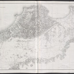
Carte de la colonisation et des travaux publics d'une partie de la province d'Alger
Permalink
https://digital.library.illinois.edu/items/fe7c27c0-5a73-0138-723d-02d0d7bfd6e4-d
This item is in the public domain.
Descriptive Information
| Title | Carte de la colonisation et des travaux publics d'une partie de la province d'Alger |
| Creator | Dépôt de la Guerre |
| Date | 1845 |
| Dimensions | 84.5 x 130 cm |
| Place of Publication | Paris (France) |
| Cartographic Scale | 1:50,000 |
| Notes |
|
| Coverage-Spatial | Africa, North |
| Genre | Maps |
| Language | French |
| Physical Location | Professor Thomas Bassett Personal Collection |
| Map No. in Bassett and Scheven Bibliography | 27 |
| Map ID | afm0003405 |
| Rights | No Copyright - United States |
| Rights Description | This item is in the public domain. |
| Collection Title | Maps of Africa to 1900 |
| Repository | Rare Book & Manuscript Library |
| Type | Cartographic material |
| Collection | Maps of Africa to 1900 |
Download Options
|
Carte de la colonisation et des travaux publics d'une partie de la province d'Alger |
Contact us
for questions and to provide feedback.