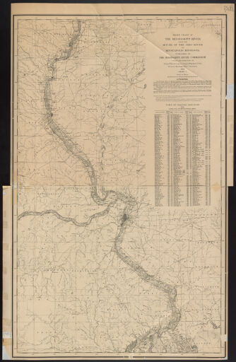
River Maps
The importance of rivers to the state of Illinois cannot be underestimated. The entire state is in the Mississippi River’s drainage basin. Rivers have historically been core to the transportation of people and goods in and out of the state. Changes in river location have changed the shape of the state. For example, a nineteenth-century Mississippi River course change cut off Kaskaskia, the first state capital, from the rest of the state. The state song for Illinois acknowledges the importance of rivers in its first line: By thy rivers gently flowing, Illinois, Illinois.
The rivers that bound and flow through Illinois are ever-changing, through both natural and man-made processes. The maps in this collection document some of those changes. Many of the maps, particularly those from the late-nineteenth and early-twentieth centuries, are large-scale showing the river in great detail.
Besides the maps included in this collection of materials, aerial photographs that include rivers in Illinois as well as of parts of the Mississippi, Ohio, and Wabash rivers on the state’s borders can be found in sets of photographs for Illinois counties in the Map Library. Indexes for these sets are available online through the Digital Collection Aerial Photographic Index Maps (https://go.library.illinois.edu/AirPhotoIndexMaps).
Older, smaller-scale maps that include rivers of Illinois and the upper Midwest may be viewed in the Historical Maps Online collection (https://go.library.illinois.edu/HistoricalMapsOnline).
Please contact the Map Library regarding these items via e-mail at charts@library.illinois.edu or by calling 217-333-0827.