
[Maps from] Field operations of the Bureau of Soils, 1911. Thirteenth report.
Permalink
https://digital.library.illinois.edu/items/07e2b530-657f-0138-727b-02d0d7bfd6e4-e
No Copyright - United States
Descriptive Information
| Title | [Maps from] Field operations of the Bureau of Soils, 1911. Thirteenth report. |
| Creator | Whitney, Milton, 1860-1927 |
| Contributor | United States. Bureau of Soils |
| Place of Publication | Washington (D.C.) |
| Publisher | United States. Government Publishing Office |
| Date of Publication | 1914 |
| Extent | 48 maps |
| Dimensions | 156 x 128 cm, or smaller, folded in portfolio 25 x 15 cm |
| Notes |
|
| Coverage-Spatial |
|
| Language | English |
| Subject | |
| Genre | Maps |
| Referenced by | Digital text available at: https://hdl.handle.net/2027/mdp.39015069835398 |
| Rights | No Copyright - United States |
| Type | Cartographic material |
| Repository | Map Library |
| Local Bib ID | 6594292 |
| Collection Title | United States Department of Agriculture Soil Maps |
| Collection | United States Department of Agriculture Soil Maps |
Download Options
|
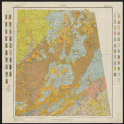
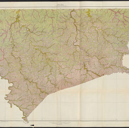
Map 1 | |

|
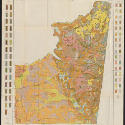
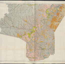
Map 2 | |
|
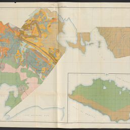
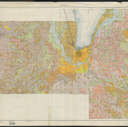
Map 3 | |
|
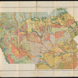
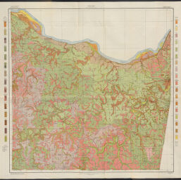
Map 4 | |
|
Map 5 | |
|
Map 6 | |

|
Map 7 | |

|
Map 8 | |
|
Map 9 | |

|
Map 10 | |
|
Map 11 | |

|
Map 12 | |
|
Map 13 | |
|
Map 14 | |

|
Map 15 | |
|
Map 16 | |
|
Map 17 | |

|
Map 18 | |

|
Map 19 | |
|
Map 20 | |

|
Map 21 | |
|
Map 22 | |

|
Map 23 | |

|
Map 24 | |

|
Map 25 | |
|
Map 26 | |
|
Map 27 | |
|
Map 28 | |

|
Map 29 | |
|
Map 30 | |
|
Map 31 | |

|
Map 32 | |
|
Map 33 | |

|
Map 34 | |

|
Map 35 | |

|
Map 36 | |
|
Map 37 | |
|
Map 38 | |
|
Map 39 | |
|
Map 40 | |

|
Map 41 | |
|
Map 42 | |
|
Map 43 | |

|
Map 44 | |
|
Map 45 | |

|
Map 46 | |
|
Map 47 | |

|
Map 48 | |
|
Map 49 | |

|
Map 50 |
Contact us
for questions and to provide feedback.