
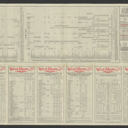
The popular through car line between the East and West : New York, Boston, Chicago, and St. Louis : the Niagara Falls route
Permalink
https://digital.library.illinois.edu/items/09b800a0-4db9-013d-4df4-02d0d7bfd6e4-f
No Copyright - United States
Descriptive Information
| Title | The popular through car line between the East and West : New York, Boston, Chicago, and St. Louis : the Niagara Falls route |
| Alternative Title | West Shore Railroad : St. Louis, Chicago, Cleveland, Detroit, Niagara Falls, Buffalo, Montreal, Saratoga, Catskills |
| Creator | Wynkoop Hallenbeck Crawford Company |
| Scale | Scale approximately 1:2,110,000 |
| Place of Publication | New York (N.Y.) |
| Publisher | Wynkoop Hallenbeck Crawford Company |
| Date of Publication | 1896-09 |
| Extent | 1 map : color |
| Dimensions | 0 x 100 cm, folded to 22 x 11 cm |
| Notes |
|
| Coverage-Spatial | |
| Language | English |
| Subject | |
| Genre | Maps |
| Rights | No Copyright - United States |
| Type | Cartographic material |
| Repository | Map Library |
| Local Bib ID | 99955561727805899 |
| Collection Title | Railroad Maps |
| Collection | Railroad Maps |
Download Options

|
99955561727805899-00000001 | |
|
99955561727805899-00000002 |
Contact us
for questions and to provide feedback.