
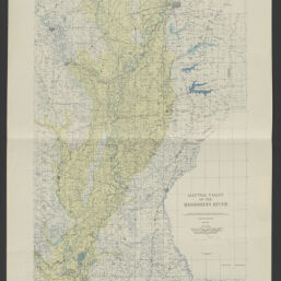
Alluvial valley of the Mississippi River /prepared by the Mississippi River Commission under the direction of the Secretary of War and the supervision of the Chief or Engineers, United States Army.
Permalink
https://digital.library.illinois.edu/items/0d3d0d00-4db9-013d-4df4-02d0d7bfd6e4-4
No Copyright - United States
Descriptive Information
| Title | Alluvial valley of the Mississippi River /prepared by the Mississippi River Commission under the direction of the Secretary of War and the supervision of the Chief or Engineers, United States Army. |
| Creator | United States. Mississippi River Commission |
| Scale | Scale 1:1,000,000 |
| Coordinates | (W 92°40ʹ--W 88°40ʹ/N 37°20ʹ--N 28°50ʹ) |
| Place of Publication | Vicksburg (Miss.) |
| Publisher | United States. Mississippi River Commision |
| Date of Publication | 1944 |
| Extent | 1 map : color |
| Dimensions | 94 x 36 cm |
| Notes |
|
| Coverage-Spatial | |
| Language | English |
| Subject | Alluvial plains |
| Associated Entities | |
| Genre | |
| Rights | No Copyright - United States |
| Type | Cartographic material |
| Repository | Map Library |
| Local Bib ID | 99955556910005899 |
| Collection Title | River Maps |
| Collection | River Maps |
Download Options
|
Alluvial valley of the Mississippi River /prepared by the Mississippi River Commission under the direction of the Secretary of War and the supervision of the Chief or Engineers, United States Army. |
Contact us
for questions and to provide feedback.