


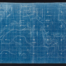
Contour map of the Mound Lake Drainage and Levee District
Permalink
https://digital.library.illinois.edu/items/0f8b2390-9cc7-0139-7888-02d0d7bfd6e4-7
No Copyright - United States
Descriptive Information
| Title | Contour map of the Mound Lake Drainage and Levee District |
| Creator | Wheeler, Charles |
| Scale | [1:12,000]. 1 in. to 1000 ft |
| Date of Publication | 1910 |
| Extent | 1 map |
| Dimensions | 56 x 98 cm |
| Notes | Relief shown by contours. |
| Coverage-Spatial | Illinois River Valley (Ill.) |
| Genre | Maps |
| Rights | No Copyright - United States |
| Type | Cartographic material |
| Repository | Map Library |
| Local Bib ID | 99162340712205899 |
| Collection Title | River Maps |
| Collection | River Maps |
Download Options
|
Contour map of the Mound Lake Drainage and Levee District |
Contact us
for questions and to provide feedback.