
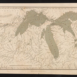
Map of the country embracing the route of the expedition of 1823 commanded by Major S.H. Long / engraved by R. Penny
Permalink
https://digital.library.illinois.edu/items/0f9b5ab0-9cc7-0139-7888-02d0d7bfd6e4-2
No Copyright - United States
Descriptive Information
| Title | Map of the country embracing the route of the expedition of 1823 commanded by Major S.H. Long / engraved by R. Penny |
| Creator | Penny, R. |
| Scale | approximately 1:3,580,000 |
| Coordinates | W 101°30ʹ--W 75°30ʹ/N 52°00ʹ--N 38°00ʹ |
| Place of Publication | London (England) |
| Publisher | Whittaker, George Byrom, 1793-1847 |
| Date of Publication | 1825 |
| Extent | 1 map |
| Dimensions | 24.4 x 51.8 cm |
| Notes |
|
| Coverage-Spatial | Minnesota River Valley (S.D. and Minn.) |
| Subject | |
| Genre | Thematic maps |
| Source | Narrative of an expedition to the source of St. Peter's River. London : Geo B. Whittaker, 1825 -- (OCoLC)4182360 |
| Rights | No Copyright - United States |
| Type | Cartographic material |
| Repository | Map Library |
| Local Bib ID | 99949003612205899 |
| Collection Title | River Maps |
| Collection | River Maps |
Download Options
|
Map of the country embracing the route of the expedition of 1823 commanded by Major S.H. Long / engraved by R. Penny |
Contact us
for questions and to provide feedback.