
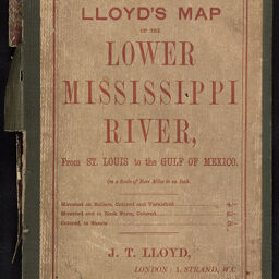
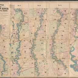
Lloyd's map of the lower Mississippi River from St. Louis to the Gulf of Mexico. compiled from government surveys in the Topographical Bureau, Washington, D.C. Revised and corrected to the present time, by Captains Bart. and William Bowen, pilots of twenty years' experience on that river
Permalink
https://digital.library.illinois.edu/items/11c21dc0-d1ed-0137-6f52-02d0d7bfd6e4-7
No Copyright - United States
Descriptive Information
| Title | Lloyd's map of the lower Mississippi River from St. Louis to the Gulf of Mexico. compiled from government surveys in the Topographical Bureau, Washington, D.C. Revised and corrected to the present time, by Captains Bart. and William Bowen, pilots of twenty years' experience on that river |
| Creator | Lloyd, James T. |
| Contributor | Bowen, William, 1836-1893 |
| Scale | ca. 1:316,800 |
| Place of Publication | New York (N.Y.) |
| Publisher | Lloyd, James T. |
| Date of Publication | 1862 |
| Extent | 1 map |
| Dimensions | 408 x 26 cm, on sheet 97 x 132 cm, folded in cover 25 x 16 cm |
| Notes |
|
| Coverage-Spatial | Mississippi River |
| Language | English |
| Genre | Maps |
| Rights | No Copyright - United States |
| Type | Cartographic material |
| Repository | Map Library |
| Local Bib ID | 1624099 |
| Collection Title | River Maps |
| Collection | River Maps |
Download Options
|
Front cover | |

|
End paper | |

|
End paper | |

|
Back cover | |
|
Map |
Contact us
for questions and to provide feedback.