
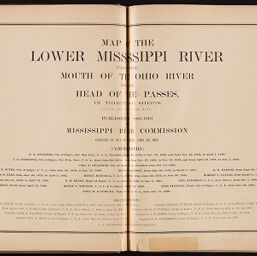
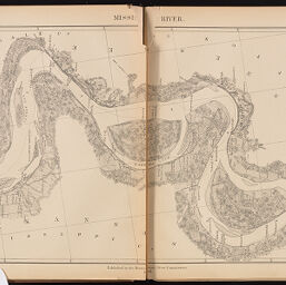
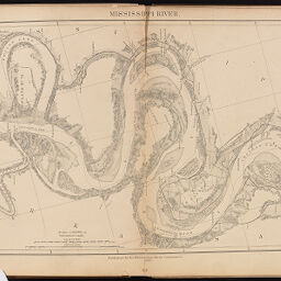
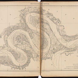
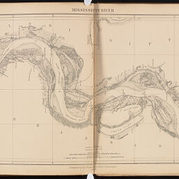
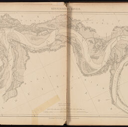
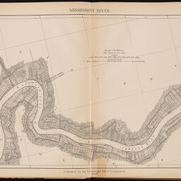
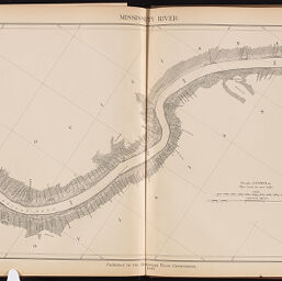
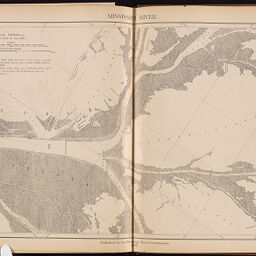
Map of the lower Mississippi River from the mouth of the Ohio River to the head of the passes, in thirty two sheets, published in 1881-1897 by the Mississippi River Commission
Permalink
https://digital.library.illinois.edu/items/11c64da0-d1ed-0137-6f52-02d0d7bfd6e4-e
No Copyright - United States
Descriptive Information
| Title | Map of the lower Mississippi River from the mouth of the Ohio River to the head of the passes, in thirty two sheets, published in 1881-1897 by the Mississippi River Commission |
| Creator | United States. Mississippi River Commission |
| Scale | 1:63,360. 1 inch to 1 mile. |
| Place of Publication | Washington (D.C.) |
| Publisher | United States. Mississippi River Commission |
| Date of Publication | 1897 |
| Extent | 2 pages; 32 maps |
| Dimensions | 39 x 62 cm |
| Notes | Includes table of mid-stream distances from Cairo to the head of passes. |
| Coverage-Spatial | Mississippi River |
| Language | English |
| Genre | Maps |
| Rights | No Copyright - United States |
| Type | Cartographic material |
| Repository | Map Library |
| Local Bib ID | 2200306 |
| Collection Title | River Maps |
| Collection | River Maps |
Download Options
|
Title Page | |

|
Table of Distances | |

|
Index Chart No. I | |

|
Index Chart No. II | |

|
Index Chart No. III | |

|
Sheet No. 1 | |

|
Sheet No. 2 | |

|
Sheet No. 3 | |

|
Sheet No. 4 | |

|
Sheet No. 5 | |
|
Sheet No. 6 | |

|
Sheet No. 7 | |

|
Sheet No. 8 | |

|
Sheet No. 9 | |

|
Sheet No. 10 | |

|
Sheet No. 11 | |

|
Sheet No. 12 | |
|
Sheet No. 13 | |
|
Sheet No. 14 | |
|
Sheet No. 15 | |

|
Sheet No. 17 | |
|
Sheet No. 18 | |

|
Sheet No. 19 | |

|
Sheet No. 22 | |

|
Sheet No. 23 | |

|
Sheet No. 24 | |

|
Sheet No. 25 | |

|
Sheet No. 26 | |

|
Sheet No. 27 | |

|
Sheet No. 28 | |
|
Sheet No. 29 | |

|
Sheet No. 30 | |
|
Sheet No. 31 | |
|
Sheet No. 32 |
Contact us
for questions and to provide feedback.