
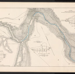
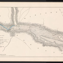
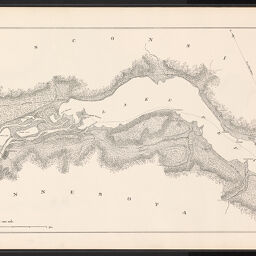
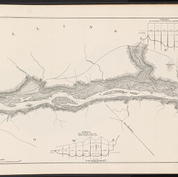
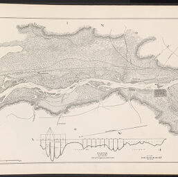
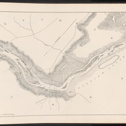
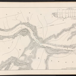
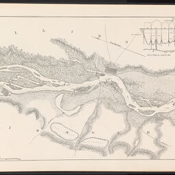
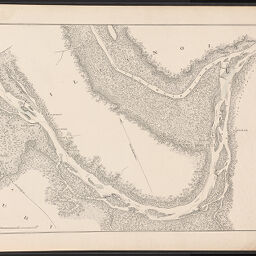
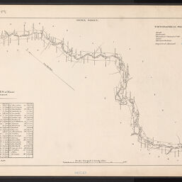
Map of the Mississippi River from the falls of St. Anthony to the junction of the Illinois River. Compiled from survey of upper Mississippi River from St. Paul to Grafton, made in 1878 and 1879 under direction of F.U. Farquhar with additions from notes and surveys under direction of G.K. Warren, J.N. Macomb, and A. Mackenzie. Drawn under the direction of A. Mackenzie by H. Bosse and A.J. Stibott
Permalink
https://digital.library.illinois.edu/items/11c94780-d1ed-0137-6f52-02d0d7bfd6e4-6
No Copyright - United States
Descriptive Information
| Title | Map of the Mississippi River from the falls of St. Anthony to the junction of the Illinois River. Compiled from survey of upper Mississippi River from St. Paul to Grafton, made in 1878 and 1879 under direction of F.U. Farquhar with additions from notes and surveys under direction of G.K. Warren, J.N. Macomb, and A. Mackenzie. Drawn under the direction of A. Mackenzie by H. Bosse and A.J. Stibott |
| Creator | United States. Army. Corps of Engineers |
| Contributor | Mackenzie, Alexander, 1844-1921 |
| Scale | 1:63,360. 1 inch to 1 mile. |
| Place of Publication | Washington (D.C.) |
| Date of Publication | 1887-1888 |
| Extent | 27 leaves |
| Dimensions | 39 x 61 cm |
| Notes |
|
| Coverage-Spatial | Mississippi River |
| Language | English |
| Genre | Maps |
| Rights | No Copyright - United States |
| Type | Cartographic material |
| Repository | Map Library |
| Local Bib ID | 2206698 |
| Collection Title | River Maps |
| Collection | River Maps |
Download Options
|
Sheet No. 1 | |
|
Sheet No. 2 | |
|
Sheet No. 3 | |

|
Sheet No. 4 | |

|
Sheet No. 5 | |

|
Sheet No. 6 | |

|
Sheet No. 7 | |

|
Sheet No. 8 | |

|
Sheet No. 9 | |

|
Sheet No. 11 | |
|
Sheet No. 12 | |

|
Sheet No. 13 | |
|
Sheet No. 14 | |

|
Sheet No. 15 | |

|
Sheet No. 16 | |
|
Sheet No. 17 | |

|
Sheet No. 17 | |

|
Sheet No. 18 | |

|
Sheet No. 19 | |

|
Sheet No. 20 | |
|
Sheet No. 21 | |

|
Sheet No. 21 | |

|
Sheet No. 22 | |
|
Sheet No. 23 | |

|
Sheet No. 24 | |

|
Sheet No. 25 | |

|
Sheet No. 26 | |
|
Sheet No. 27 | |

|
Sheet No. 27 | |

|
Index sheet 1 | |
|
Index Sheet 2 |
Contact us
for questions and to provide feedback.