
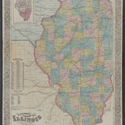
Blanchard's township map of Illinois : showing all the rail roads, stations and towns : being a complete shippers guide to the state with parts of Iowa and Missouri
Illinois
Permalink
https://digital.library.illinois.edu/items/1c97fe60-d050-013b-46a1-02d0d7bfd6e4-e
No Copyright - United States
Descriptive Information
| Title | Blanchard's township map of Illinois : showing all the rail roads, stations and towns : being a complete shippers guide to the state with parts of Iowa and Missouri |
| Alternative Title | Illinois |
| Creator | Blanchard, Rufus, 1821-1904 |
| Scale | Scale 1:760,320. 12 miles to 1 inch |
| Coordinates | W 92°40ʹ--W 88°00ʹ/N 42°36ʹ--N 36°54ʹ |
| Place of Publication | Chicago (Ill.) |
| Publisher | Blanchard, Rufus, 1821-1904 |
| Date of Publication | 1869 |
| Extent | 1 map : hand color |
| Dimensions | 83 x 57 cm, folded to 13 x 8 cm |
| Notes |
|
| Coverage-Spatial | Illinois |
| Language | English |
| Subject | |
| Genre | Maps |
| Rights | No Copyright - United States |
| Type | Cartographic material |
| Repository | Map Library |
| Local Bib ID | 99161138912205899 |
| Collection Title | Railroad Maps |
| Collection | Railroad Maps |
Download Options
|
Blanchard's township map of Illinois : showing all the rail roads, stations and towns : being a complete shippers guide to the state with parts of Iowa and Missouri |
Contact us
for questions and to provide feedback.