
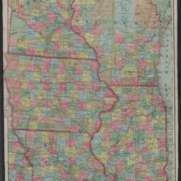
Blanchard's map of the north western states : showing the counties, towns, railroads, stations, steamboat landing etc. compiled from the most authentic sources
North western States
Permalink
https://digital.library.illinois.edu/items/1cc3c240-d050-013b-46a1-02d0d7bfd6e4-1
No Copyright - United States
Descriptive Information
| Title | Blanchard's map of the north western states : showing the counties, towns, railroads, stations, steamboat landing etc. compiled from the most authentic sources |
| Alternative Title | North western States |
| Creator | Blanchard, Rufus, 1821-1904 |
| Scale | Scale [1:1,267,200]. 20 miles to an in. |
| Place of Publication | Chicago (Ill.) |
| Publisher | Blanchard, Rufus, 1821-1904 |
| Date of Publication | 1867 |
| Extent | 1 map : color |
| Dimensions | 97 x 63 cm |
| Notes |
|
| Coverage-Spatial | Middle West |
| Language | English |
| Subject | Railroads |
| Associated Entities | Charles Shober & Co. |
| Genre | Maps |
| Rights | No Copyright - United States |
| Type | Cartographic material |
| Repository | Map Library |
| Local Bib ID | 99161538512205899 |
| Collection Title | Railroad Maps |
| Collection | Railroad Maps |
Download Options
|
Blanchard's map of the north western states : showing the counties, towns, railroads, stations, steamboat landing etc. compiled from the most authentic sources |
Contact us
for questions and to provide feedback.