
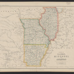
States of Illinois, Missouri, and Arkansas
Permalink
https://digital.library.illinois.edu/items/1d258f00-d050-013b-46a1-02d0d7bfd6e4-2
No Copyright - United States
Descriptive Information
| Title | States of Illinois, Missouri, and Arkansas |
| Creator | Rogers, Henry D. (Henry Darwin), 1808-1866 |
| Scale | Scale 1:3,450,000. 54 1/2 miles to 1 in. |
| Coordinates | W 100°00ʹ--W 84°00ʹ/N 42°30ʹ--N 33°00ʹ |
| Place of Publication |
|
| Publisher | |
| Date of Publication | 1857 |
| Extent | 1 map : hand-colored |
| Dimensions | 31 x 39 cm |
| Notes |
|
| Coverage-Spatial | |
| Language | English |
| Associated Entities | |
| Genre | Maps |
| Rights | No Copyright - United States |
| Type | Cartographic material |
| Repository | Map Library |
| Local Bib ID | 99162457412205899 |
| Collection Title | Railroad Maps |
| Collection | Railroad Maps |
Download Options
|
States of Illinois, Missouri, and Arkansas |
Contact us
for questions and to provide feedback.