
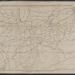
Gest's map of railways centering at Cincinnati with their tributary lines in adjoining states and Canada west
Permalink
https://digital.library.illinois.edu/items/1d31ac90-d050-013b-46a1-02d0d7bfd6e4-4
No Copyright - United States
Descriptive Information
| Title | Gest's map of railways centering at Cincinnati with their tributary lines in adjoining states and Canada west |
| Creator | Lewis, I. T. |
| Place of Publication | Cincinnati (Ohio) |
| Publisher | |
| Date of Publication | 1853 |
| Extent | 1 map |
| Dimensions | 53 x 65 cm |
| Notes |
|
| Coverage-Spatial | Middle West |
| Language | English |
| Subject | Railroads |
| Associated Entities | |
| Genre | Maps |
| Rights | No Copyright - United States |
| Type | Cartographic material |
| Repository | Map Library |
| Local Bib ID | 99162483012205899 |
| Collection Title | Railroad Maps |
| Collection | Railroad Maps |
Download Options
|
Gest's map of railways centering at Cincinnati with their tributary lines in adjoining states and Canada west |
Contact us
for questions and to provide feedback.