
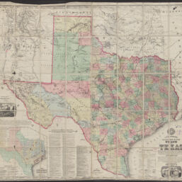
A.R. Roessler's latest map of the State of Texas : exhibiting mineral and agricultural districts, railroads projected and finished, timber, prairie, swamp lands, etc. etc. etc.
A.R. Roessler's latest map of the State of Texas : exhibiting mineral and agricultural districts, railroads projected and finished, timber, prairie, swamp lands, etc. etc. etc. / authorities: official maps of the U.S. & Texas State General Land-Offices, surveys and reconnoissances of the U.S. Coast Survey, the various rail road surveys, U.S. Mexican Boundary Commission surveys, U.S. Dngineer Dept. and other authentic materials
Permalink
https://digital.library.illinois.edu/items/1d833d30-d050-013b-46a1-02d0d7bfd6e4-6
No Copyright - United States
Descriptive Information
| Title | A.R. Roessler's latest map of the State of Texas : exhibiting mineral and agricultural districts, railroads projected and finished, timber, prairie, swamp lands, etc. etc. etc. |
| Alternative Title |
|
| Creator | Roessler, A. R. |
| Scale | Scale approximately 1:1,267,200 |
| Place of Publication | New York (N.Y.) |
| Publisher | Ed. W. Welcke & Bro. |
| Date of Publication | 1874 |
| Extent | 1 map : sectioned and mounted on fabric, color |
| Dimensions | 94 x 104 cm, folded to 18 cm |
| Notes |
|
| Coverage-Spatial | Texas |
| Language | English |
| Subject | Railroads |
| Associated Entities | Mittendorfer, Maximilian von |
| Genre | Maps |
| Rights | No Copyright - United States |
| Type | Cartographic material |
| Repository | Map Library |
| Local Bib ID | 99399194912205899 |
| Collection Title | Railroad Maps |
| Collection | Railroad Maps |
Download Options
|
A.R. Roessler's latest map of the State of Texas : exhibiting mineral and agricultural districts, railroads projected and finished, timber, prairie, swamp lands, etc. etc. etc. |
Contact us
for questions and to provide feedback.