


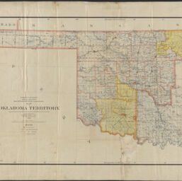
Map of Oklahoma Territory
Permalink
https://digital.library.illinois.edu/items/1e61b0a0-d050-013b-46a1-02d0d7bfd6e4-6
No Copyright - United States
Descriptive Information
| Title | Map of Oklahoma Territory |
| Creator | Hendges, M. |
| Scale | Scale 1:760,320. 1 inch = 12 miles |
| Coordinates | W 103°--W 96°/N 37°--N 34° |
| Place of Publication | Washington (D.C.) |
| Publisher | United States. General Land Office |
| Date of Publication | 1898 |
| Extent | 1 map : color |
| Dimensions | 58 x 89 cm, on sheet 73 x 101 cm |
| Notes |
|
| Coverage-Spatial | Oklahoma |
| Language | English |
| Subject | |
| Associated Entities | |
| Genre | Maps |
| Rights | No Copyright - United States |
| Type | Cartographic material |
| Repository | Map Library |
| Local Bib ID | 99955259913905899 |
| Collection Title | Railroad Maps |
| Collection | Railroad Maps |
Download Options
|
Map of Oklahoma Territory |
Contact us
for questions and to provide feedback.