
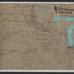
Map of the Chicago, Milwaukee and St. Paul Railway and connections
Permalink
https://digital.library.illinois.edu/items/1e81c130-d050-013b-46a1-02d0d7bfd6e4-8
No Copyright - United States
Descriptive Information
| Title | Map of the Chicago, Milwaukee and St. Paul Railway and connections |
| Creator | American Bank Note Company |
| Scale | Scale approximately 1:3,487,000. |
| Place of Publication | New York (N.Y.) |
| Publisher | American Bank Note Company |
| Date of Publication | 1886 |
| Extent | 1 map : color |
| Dimensions | 41 x 46 cm |
| Notes |
|
| Coverage-Spatial | |
| Language | English |
| Subject | |
| Associated Entities | |
| Genre | Maps |
| Rights | No Copyright - United States |
| Type | Cartographic material |
| Repository | Map Library |
| Local Bib ID | 99955259922405899 |
| Collection Title | Railroad Maps |
| Collection | Railroad Maps |
Download Options
|
Map of the Chicago, Milwaukee and St. Paul Railway and connections |
Contact us
for questions and to provide feedback.