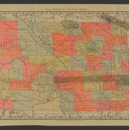
The items in the Digital Collections of the University of Illinois Urbana-Champaign Library contain materials which represent or depict sensitive topics or were written from perspectives using outdated or biased language. The Library condemns discrimination and hatred on any grounds. As a research library that supports the mission and values of this land grant institution, it is incumbent upon the University Library to preserve, describe, and provide access to materials to accurately document our past, support learning about it, and effect change in the present. In accordance with the American Library Association’s Freedom to Read statement, we do not censor our materials or prevent patrons from accessing them.
Title in lower left corner of map: Rand, McNally & Co.'s new business atlas map of North Dakota
Title of index on verso: North Dakota counties, creeks, lakes, mountains, hills, buttes, rivers, and towns
Creator
Rand McNally and Company
Scale
Scale 1:126,720. 21 miles = 1 inch. 34 km = 1 inch
Coordinates
W 104°00ʹ--W 96°30ʹ/N 49°00ʹ--N 45°55ʹ
Place of Publication
Chicago (Ill.)
Publisher
Rand McNally and Company
Date of Publication
1904
Extent
1 map : color
Dimensions
31 x 47 cm
Notes
Relief shown by hachures.
Overprint includes numbered list of 7 railroad companies and indicates on map of lines owned by companies. Additionally, 23 counties are overprinted in solid red without indication of meaning.
Additional copyright statement: Copyright, 1895, by Rand, McNally & Co.
Index on verso includes populations from 1900 census.