
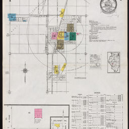
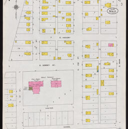
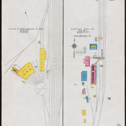
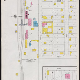
Benld including Mont Clare and Sawyerville, Macoupin County, Illinois, February 1925
Permalink
https://digital.library.illinois.edu/items/3ba24cc0-1594-0139-75b2-02d0d7bfd6e4-6
In the public domain.
Descriptive Information
| Title | Benld including Mont Clare and Sawyerville, Macoupin County, Illinois, February 1925 |
| Creator | Sanborn Map Company |
| Coverage-Spatial | Benld (Ill.) |
| Genre | Fire insurance maps |
| Subject | Fire insurance |
| Publisher | Sanborn Map & Publishing Co. |
| Date of Publication | 1925 |
| Place of Publication | New York (N.Y.) |
| Scale | ca. 1:600 |
| Language | English |
| Notes |
|
| Extent | 10 maps : color |
| Dimensions | 64 x 54 cm |
| Coordinates | W 89⁰48ʹ14ʺ/N 39⁰05ʹ34ʺ |
| Rights | No Copyright - United States |
| Rights Description | In the public domain. |
| Type | Cartographic material |
| Repository | Map Library |
| Local Bib ID | 99161344312205899 |
| Collection Title | Sanborn Fire Insurance Maps |
| Collection | Sanborn Fire Insurance Maps |
Download Options
|
Sheet 1 | |
|
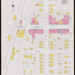
Sheet 2 | |
|
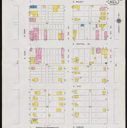
Sheet 3 | |

|
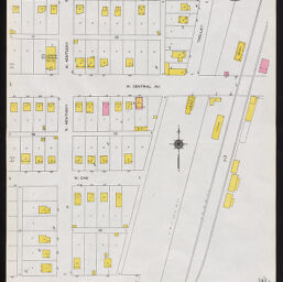
Sheet 4 | |

|
Sheet 5 | |
|
Sheet 6 | |
|
Sheet 7 | |
|
Sheet 8 | |
|
Sheet 9 | |

|
Sheet 10 |
Contact us
for questions and to provide feedback.