
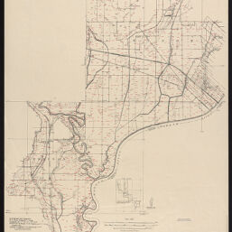
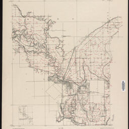
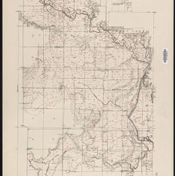
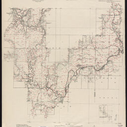
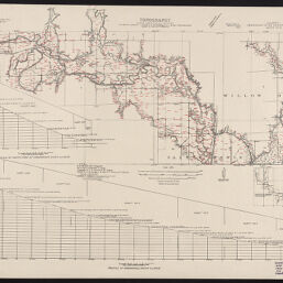
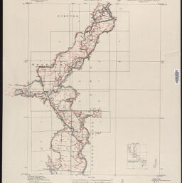
Embarass River drainage project
Permalink
https://digital.library.illinois.edu/items/533c5da0-5a64-0139-7734-02d0d7bfd6e4-a
No Copyright - United States
Descriptive Information
| Title | Embarass River drainage project |
| Creator | Illinois State Geological Survey |
| Contributor | Geological Survey (U.S.) |
| Scale | 1:24,000 |
| Coordinates | W 88⁰15'--W 87⁰32'/N 39⁰15'--N 38⁰37' |
| Place of Publication | Urbana (Ill.) |
| Publisher | Illinois State Geological Survey |
| Date of Publication | 1914 |
| Extent | 1 map on 8 sheets |
| Dimensions | sheets 82 x 69 cm and 69 x 82 cm |
| Notes |
|
| Coverage-Spatial | Embarass River (Ill.) |
| Language | English |
| Genre | Topographic maps |
| Rights | No Copyright - United States |
| Type | Cartographic material |
| Repository | Map Library |
| Local Bib ID | 99399318312205899 |
| Collection Title | River Maps |
| Collection | River Maps |
Download Options
|
99399318312205899-001 | |
|
99399318312205899-002 | |
|
99399318312205899-003 | |
|
99399318312205899-004 | |
|
99399318312205899-005 | |

|
99399318312205899-006 | |
|
99399318312205899-007 | |

|
99399318312205899-008 |
Contact us
for questions and to provide feedback.