The items in the Digital Collections of the University of Illinois Urbana-Champaign Library contain materials which represent or depict sensitive topics or were written from perspectives using outdated or biased language. The Library condemns discrimination and hatred on any grounds. As a research library that supports the mission and values of this land grant institution, it is incumbent upon the University Library to preserve, describe, and provide access to materials to accurately document our past, support learning about it, and effect change in the present. In accordance with the American Library Association’s Freedom to Read statement, we do not censor our materials or prevent patrons from accessing them.
University of Illinois at Urbana-Champaign. Department of Forestry
County
Piatt County
Country
United States
State
Illinois
Subject
Phytogeography
Genre
Maps
Date
1946-1949
Scale
Scale 1:10,560. 6 in. = 1 mile
Description
Shows boundary, roads, trails, Sangamon River, grass, shrubs, young forest, virgin mature forest, scattered trees, buildings, and landscaping.
Earliest possible publication date is 1946 because the Department of Forestry was first involved in research and education related to the Allerton properties in 1946.
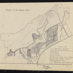
Diagram of the Allerton Tract. (1946). Allerton Park Maps and Air Photos, Map Library, University of Illinois at Urbana-Champaign Library. https://digital.library.illinois.edu/items/579840d0-b753-0139-78e9-02d0d7bfd6e4-8