
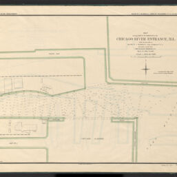
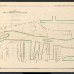
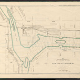
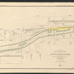
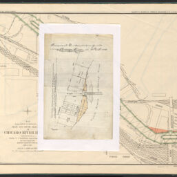
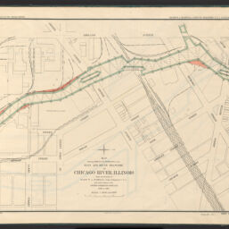
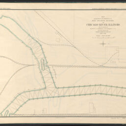
Atlas containing maps of Chicago River, Illinois and its branches : showing result of improvement by the U.S. government
Permalink
https://digital.library.illinois.edu/items/6046f330-bf78-013b-4675-02d0d7bfd6e4-e
No Copyright - United States
Descriptive Information
| Title | Atlas containing maps of Chicago River, Illinois and its branches : showing result of improvement by the U.S. government |
| Alternative Title | Atlas of Chicago River and branches |
| Creator | Grohmann, A. T. |
| Scale | Scale 1:1,200. 1 in. = 100 ft. |
| Coordinates | W 87°38′16″/N 41°53′11″ |
| Place of Publication | Washington (D.C.) |
| Publisher | United States. Army. Corps of Engineers |
| Date of Publication | 1899 |
| Extent | 1 atlas ([25] pages) : color maps |
| Dimensions | 59 x 74 cm |
| Notes |
|
| Coverage-Spatial | Chicago River (Ill.) |
| Language | English |
| Associated Entities | |
| Genre | |
| Rights | No Copyright - United States |
| Type | Cartographic material |
| Repository | Map Library |
| Local Bib ID | 99955221121405899 |
| Collection Title | River Maps |
| Collection | River Maps |
Download Options
|
99955221121405899-001 | |

|
99955221121405899-002 | |

|
99955221121405899-003 | |
|
99955221121405899-004 | |
|
99955221121405899-005 | |

|
99955221121405899-006 | |
|
99955221121405899-007 | |

|
99955221121405899-008 | |
|
99955221121405899-009 | |

|
99955221121405899-010 | |

|
99955221121405899-011 | |
|
99955221121405899-012 | |

|
99955221121405899-013 | |

|
99955221121405899-014 | |

|
99955221121405899-015 | |

|
99955221121405899-016 | |
|
99955221121405899-017 | |

|
99955221121405899-018 | |
|
99955221121405899-019 | |

|
99955221121405899-020 | |

|
99955221121405899-021 | |

|
99955221121405899-022 | |

|
99955221121405899-023 | |

|
99955221121405899-024 | |

|
99955221121405899-025 | |

|
99955221121405899-026 | |

|
99955221121405899-027 | |

|
99955221121405899-028 | |

|
99955221121405899-029 | |

|
99955221121405899-030 | |

|
99955221121405899-031 | |

|
99955221121405899-032 |
Contact us
for questions and to provide feedback.