
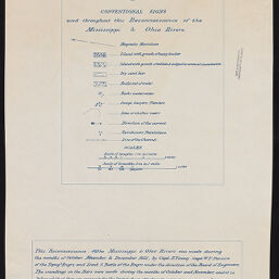
Reconnoissance of the Mississippi & Ohio Rivers made during the months of October, November & December 1821, by Capt. H. Young -Capt. W.T. Poussin of the Topog. l Engrs. and Lieut. S. Tuttle of the Engrs.
Permalink
https://digital.library.illinois.edu/items/8b1edad0-d675-0137-6f52-02d0d7bfd6e4-4
No Copyright - United States
Descriptive Information
| Title | Reconnoissance of the Mississippi & Ohio Rivers made during the months of October, November & December 1821, by Capt. H. Young -Capt. W.T. Poussin of the Topog. l Engrs. and Lieut. S. Tuttle of the Engrs. |
| Alternative Title | Map of reconnaissance of Mississippi River |
| Contributor | |
| Scale | [ca. 1:63,360] and [ca. 1:32,000]. Scale of lengths 1 in. to 1 mile. Scale of breadths 2 in. to 1 mile. |
| Publisher | United States. Army. Board of Engineers |
| Date of Publication | 1821 |
| Extent | 2 maps on 3 sheets |
| Dimensions | 47 x 32 cm |
| Notes |
|
| Coverage-Spatial | Mississippi River |
| Language | English |
| Genre | Maps |
| Rights | No Copyright - United States |
| Type | Cartographic material |
| Repository | Map Library |
| Local Bib ID | 6914179 |
| Collection Title | River Maps |
| Collection | River Maps |
Download Options
|
Title Page | |

|
Sheet No. 4 | |

|
Sheet No. 5 |
Contact us
for questions and to provide feedback.