
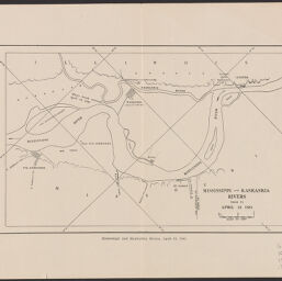
Mississippi and Kaskaskia rivers prior to April 18, 1881
Mississippi and Kaskaskia rivers, April 18, 1881
Permalink
https://digital.library.illinois.edu/items/8b25e920-d675-0137-6f52-02d0d7bfd6e4-2
No Copyright - United States
Descriptive Information
| Title | Mississippi and Kaskaskia rivers prior to April 18, 1881 |
| Alternative Title | Mississippi and Kaskaskia rivers, April 18, 1881 |
| Creator | Burnham, John H. (John Howard), 1834-1917 |
| Contributor | Illinois State Historical Library |
| Scale | approximately 1:10,000 |
| Coordinates | W 90°07ʹ--W 89°46ʹ/N 38°04ʹ--N 37°47ʹ |
| Place of Publication | Springfield (Ill.) |
| Publisher | Illinois State Historical Library |
| Date of Publication | 1915 |
| Extent | 1 map |
| Dimensions | 14 x 22 cm |
| Notes |
|
| Coverage-Spatial | Kaskaskia River (Ill.) |
| Language | English |
| Genre | Maps |
| Rights | No Copyright - United States |
| Type | Cartographic material |
| Repository | Map Library |
| Local Bib ID | 8700019 |
| Collection Title | River Maps |
| Collection | River Maps |
Download Options
|
Mississippi and Kaskaskia rivers prior to April 18, 1881 |
Contact us
for questions and to provide feedback.