
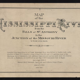
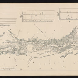
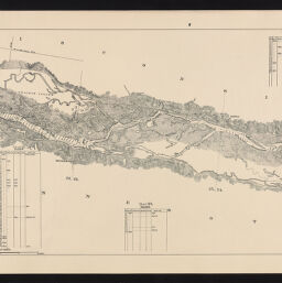
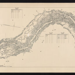
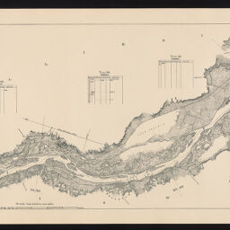
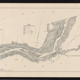
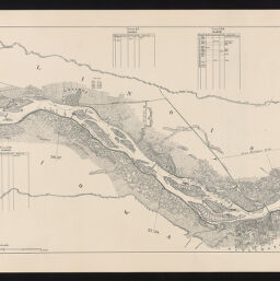
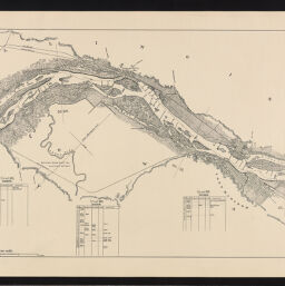
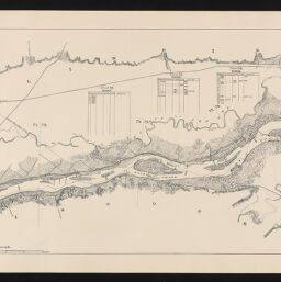
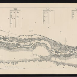
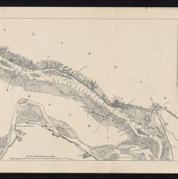
Map of the Mississippi River from the Falls of St. Anthony to the junction of the Missouri River in twenty seven sheets. Compiled from maps of survey of upper Mississippi River from St. Paul to Grafton made under direction of Major F.U. Farquhar, Corps of Eng'rs. in 1878 and 1879 and from maps of the Mississippi River Commission, with additions from notes and surveys made under the direction of Lt. Col. A. Mackenzie, Lt. Col. W.R. King and Maj. C. McD. Townsend, Corps of Eng'rs drawn under the direction of Majors C. McD. Townsend, Jas. L. Lusk, and C.S. Riche, Corps of Eng'rs. by H. Bosse and A.J. Stibolt
Permalink
https://digital.library.illinois.edu/items/8b35a6d0-d675-0137-6f52-02d0d7bfd6e4-1
No Copyright - United States
Descriptive Information
| Title | Map of the Mississippi River from the Falls of St. Anthony to the junction of the Missouri River in twenty seven sheets. Compiled from maps of survey of upper Mississippi River from St. Paul to Grafton made under direction of Major F.U. Farquhar, Corps of Eng'rs. in 1878 and 1879 and from maps of the Mississippi River Commission, with additions from notes and surveys made under the direction of Lt. Col. A. Mackenzie, Lt. Col. W.R. King and Maj. C. McD. Townsend, Corps of Eng'rs drawn under the direction of Majors C. McD. Townsend, Jas. L. Lusk, and C.S. Riche, Corps of Eng'rs. by H. Bosse and A.J. Stibolt |
| Creator | United States. Army. Corps of Engineers |
| Contributor | |
| Scale | 1:63,360. 1 in. to 1 mile. |
| Place of Publication | Washington (D.C.) |
| Publisher | United States. Army. Corps of Engineers |
| Date of Publication | 1903-1905 |
| Extent | 27 maps, title sheet and index map |
| Dimensions | 36 x 61 cm |
| Notes |
|
| Coverage-Spatial | Mississippi River |
| Language | English |
| Subject | Nautical charts |
| Genre | |
| Rights | No Copyright - United States |
| Type | Cartographic material |
| Repository | Map Library |
| Local Bib ID | 8869628 |
| Collection Title | River Maps |
| Collection | River Maps |
Download Options
|
Title Page | |
|
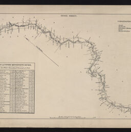
Index Sheet | |

|
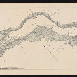
Sheet 1 | |

|
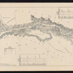
Sheet 2 | |
|
Sheet 3 | |
|
Sheet 4 | |
|
Sheet 5 | |

|
Sheet 6 | |
|
Sheet 7 | |
|
Sheet 8 | |

|
Sheet 9 | |

|
Sheet 10 | |

|
Sheet 11 | |
|
Sheet 12 | |

|
Sheet 13 | |

|
Sheet 14 | |

|
Sheet 15 | |
|
Sheet 16 | |

|
Sheet 17 | |
|
Sheet 18 | |
|
Sheet 19 | |

|
Sheet 20 | |

|
Sheet 21 | |

|
Sheet 22 | |
|
Sheet 23 | |

|
Sheet 24 | |
|
Sheet 25 | |

|
Sheet 26 | |
|
Sheet 27 |
Contact us
for questions and to provide feedback.