
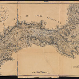
Map of the Country of the Illinois, part of upper Louisiana
Permalink
https://digital.library.illinois.edu/items/8b3e30f0-d675-0137-6f52-02d0d7bfd6e4-f
No Copyright - United States
Descriptive Information
| Title | Map of the Country of the Illinois, part of upper Louisiana |
| Creator | Collot, Georges-Henri-Victor, 1750-1805 |
| Contributor | Illinois State Historical Library |
| Scale | approximately 1:134,000 |
| Place of Publication | Springfield (Ill.) |
| Publisher | Illinois State Historical Library |
| Date of Publication | 1907 |
| Extent | 1 map |
| Dimensions | 36 x 58 cm |
| Notes |
|
| Coverage-Spatial | Saint Louis Region (Mo.) |
| Language | English |
| Genre | |
| Rights | No Copyright - United States |
| Type | Cartographic material |
| Repository | Map Library |
| Local Bib ID | 8953316 |
| Collection Title | River Maps |
| Collection | River Maps |
Download Options
|
Map of the Country of the Illinois, part of upper Louisiana |
Contact us
for questions and to provide feedback.