
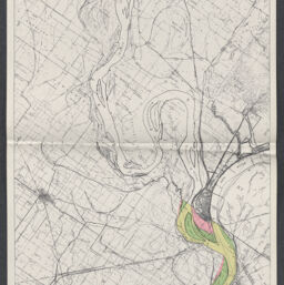
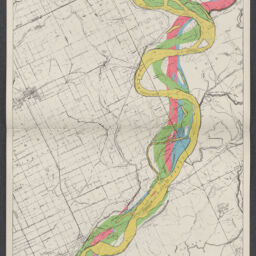
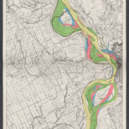
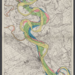
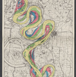
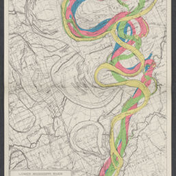
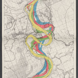
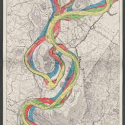
Lower Mississippi River : early stream channels at approximate half-century intervals, Cairo, Ill. to Baton Rouge, La., mile 0 to 842
Permalink
https://digital.library.illinois.edu/items/8bc8b640-04a4-013c-47d9-02d0d7bfd6e4-a
No Copyright - United States
Descriptive Information
| Title | Lower Mississippi River : early stream channels at approximate half-century intervals, Cairo, Ill. to Baton Rouge, La., mile 0 to 842 |
| Alternative Title | Early stream channels at approximate half-century intervals |
| Creator | United States. Mississippi River Commission |
| Scale | Scale approximately 1:63,360 |
| Place of Publication |
|
| Publisher | |
| Date of Publication | |
| Extent | 12 maps color |
| Dimensions | 18 x 50 in. (folded in case) |
| Notes |
|
| Coverage-Spatial | Mississippi River |
| Language | English |
| Subject | |
| Genre | |
| Rights | No Copyright - United States |
| Type | Cartographic material |
| Repository | Map Library |
| Local Bib ID | 99399231312205899 |
| Collection Title | River Maps |
| Collection | River Maps |
Download Options
|
99399231312205899-001 | |

|
99399231312205899-002 | |
|
99399231312205899-003 | |
|
99399231312205899-004 | |
|
99399231312205899-005 | |

|
99399231312205899-006 | |
|
99399231312205899-007 | |

|
99399231312205899-008 | |
|
99399231312205899-009 | |
|
99399231312205899-010 | |
|
99399231312205899-011 | |

|
99399231312205899-012 |
Contact us
for questions and to provide feedback.