


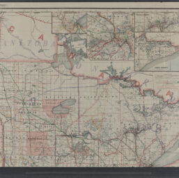
Railroad commissioners' map of Minnesota : corrected to Feb. 1, 1911
Permalink
https://digital.library.illinois.edu/items/8f254b90-04a0-013c-47d9-02d0d7bfd6e4-2
No Copyright - United States
Descriptive Information
| Title | Railroad commissioners' map of Minnesota : corrected to Feb. 1, 1911 |
| Creator | Railroad and Warehouse Commission of the State of Minnesota |
| Scale | Scale ca. 1:630,000 |
| Coordinates | W 97°15ʹ--W 89°30ʹ/N 49°23ʹ--N 43°30ʹ |
| Place of Publication | Chicago (Ill.) |
| Publisher | George F. Cram Company |
| Date of Publication | 1911 |
| Extent | 1 map on 2 sheets : color |
| Dimensions | 122 x 77 cm, sheets 64 x 78 cm |
| Notes |
|
| Coverage-Spatial | |
| Language | English |
| Subject | |
| Associated Entities | Cram, George Franklin, 1841-1928 |
| Genre | Maps |
| Rights | No Copyright - United States |
| Type | Cartographic material |
| Repository | Map Library |
| Local Bib ID | 99161120512205899 |
| Collection Title | Railroad Maps |
| Collection | Railroad Maps |
Download Options
|
99161120512205899-001 | |

|
99161120512205899-002 | |

|
99161120512205899-003 | |

|
99161120512205899-004 |
Contact us
for questions and to provide feedback.