
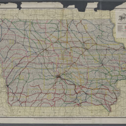
Map of Iowa
Permalink
https://digital.library.illinois.edu/items/8f420670-04a0-013c-47d9-02d0d7bfd6e4-7
No Copyright - United States
Descriptive Information
| Title | Map of Iowa |
| Creator | Kenyon Printing & Mfg Co. |
| Scale | Scale [1:506,880]. 8 miles to 1 inch |
| Coordinates | W 96°50ʹ--W 90°00ʹ/N 43°50ʹ--N 40°10ʹ |
| Place of Publication | Des Moines (Iowa) |
| Publisher | |
| Date of Publication | 1911 |
| Extent | 1 map : color |
| Dimensions | 77 x 110 cm |
| Notes |
|
| Coverage-Spatial | Iowa |
| Language | English |
| Subject | Railroads |
| Associated Entities | Iowa. Board of Railroad Commissioners |
| Genre | |
| Rights | No Copyright - United States |
| Type | Cartographic material |
| Repository | Map Library |
| Local Bib ID | 99162560512205899 |
| Collection Title | Railroad Maps |
| Collection | Railroad Maps |
Download Options
|
99162560512205899-001 | |

|
99162560512205899-002 |
Contact us
for questions and to provide feedback.