
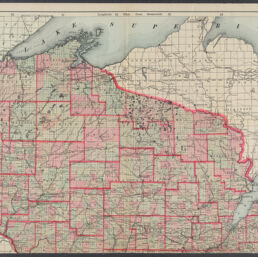
Tunison's new railroad, distance, township and sectional map of Wisconsin from latest surveys
Permalink
https://digital.library.illinois.edu/items/8f9dc100-04a0-013c-47d9-02d0d7bfd6e4-0
No Copyright - United States
Descriptive Information
| Title | Tunison's new railroad, distance, township and sectional map of Wisconsin from latest surveys |
| Creator | Tunison, Henry Cuthbert, 1855- |
| Scale | Scale approximately 1:538,000 |
| Coordinates | W 92°53ʹ--W 86°14ʹ/N 47°18ʹ--N 42°29ʹ |
| Place of Publication | Jacksonville (Ill.) |
| Publisher | H.C. Tunison (Firm) |
| Date of Publication | 1899 |
| Extent | 1 map on 2 sheets : hand colored |
| Dimensions | 99 x 87 cm |
| Notes |
|
| Coverage-Spatial | Wisconsin |
| Language | English |
| Subject | |
| Associated Entities | H.C. Tunison (Firm) |
| Genre | Maps |
| Rights | No Copyright - United States |
| Type | Cartographic material |
| Repository | Map Library |
| Local Bib ID | 99955242512505899 |
| Collection Title | Railroad Maps |
| Collection | Railroad Maps |
Download Options
|
99955242512505899-001 | |

|
99955242512505899-002 |
Contact us
for questions and to provide feedback.