
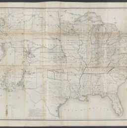
Map of the United States and territories : shewing the extent of public surveys and other details
Permalink
https://digital.library.illinois.edu/items/8fb510c0-04a0-013c-47d9-02d0d7bfd6e4-0
No Copyright - United States
Descriptive Information
| Title | Map of the United States and territories : shewing the extent of public surveys and other details |
| Creator | United States. General Land Office |
| Contributor | |
| Scale | Scale approximately 1:3,900,000 |
| Coordinates | W 124°--W 68°/N 49°--N 25° |
| Place of Publication |
|
| Publisher | |
| Date of Publication | 1866 |
| Extent | 1 map : hand colored |
| Dimensions | 69 x 137 cm |
| Notes |
|
| Coverage-Spatial | United States |
| Language | English |
| Subject | |
| Associated Entities | |
| Genre | Maps |
| Rights | No Copyright - United States |
| Type | Cartographic material |
| Repository | Map Library |
| Local Bib ID | 99955329550405899 |
| Collection Title | Railroad Maps |
| Collection | Railroad Maps |
Download Options
|
Map of the United States and territories : shewing the extent of public surveys and other details |
Contact us
for questions and to provide feedback.