
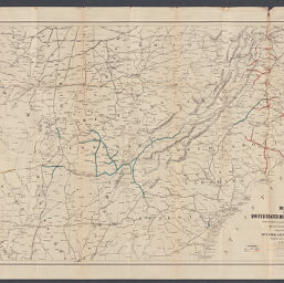
Map of United States military rail roads, showing the rail roads operated during the war from 1862-1866, as military lines
United States military rail roads, showing the rail roads operated during the war from 1862-1866
Permalink
https://digital.library.illinois.edu/items/acc418d0-2fac-013a-7ba8-02d0d7bfd6e4-e
No Copyright - United States
Descriptive Information
| Title | Map of United States military rail roads, showing the rail roads operated during the war from 1862-1866, as military lines |
| Alternative Title |
|
| Creator | Bien, Julius, 1826-1909 |
| Contributor | McCallum, D. C. |
| Scale | Scale approximately 1:1,875,000. |
| Place of Publication | New York (N.Y.) |
| Publisher | Julius Bien & Co. |
| Date of Publication | 1866 |
| Extent | 1 map : color |
| Dimensions | 62 x 96 cm |
| Notes |
|
| Coverage-Spatial | United States |
| Language | English |
| Subject | |
| Genre | Maps |
| Rights | No Copyright - United States |
| Type | Cartographic material |
| Repository | Map Library |
| Local Bib ID | 99954918344905899 |
| Collection Title | Railroad Maps |
| Collection | Railroad Maps |
Download Options
|
Map of United States military rail roads, showing the rail roads operated during the war from 1862-1866, as military lines |
Contact us
for questions and to provide feedback.