
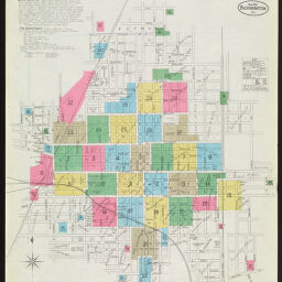
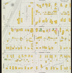
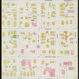
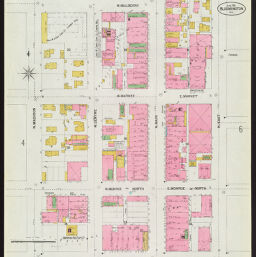
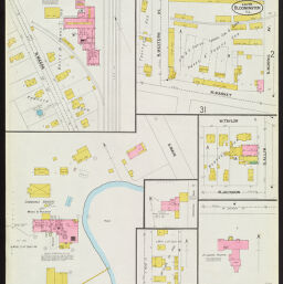
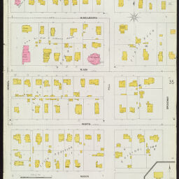
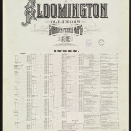
Insurance Maps of Bloomington, Illinois, June 1901
Permalink
https://digital.library.illinois.edu/items/ad664040-c451-0133-1d17-0050569601ca-2
In the public domain.
Descriptive Information
| Title | Insurance Maps of Bloomington, Illinois, June 1901 |
| Creator | Sanborn-Perris Map Co. |
| Coverage-Spatial | Bloomington (Ill.) |
| Genre | Fire insurance maps |
| Subject | Fire risk assessment |
| Publisher | Sanborn-Perris Map Co. |
| Date of Publication | 1901 |
| Place of Publication | New York (N.Y.) |
| Scale | Scale ca. 1:600. 50 ft. to 1 in. |
| Language | English |
| Notes |
|
| Extent | 36 maps : color |
| Dimensions | 64 x 54 cm |
| Coordinates | (W 88⁰59'37"/N 40⁰29'03") |
| Rights | No Copyright - United States |
| Rights Description | In the public domain. |
| Type | Cartographic material |
| Repository | Map Library |
| Local Bib ID | 1613492 |
| Collection Title | Sanborn Fire Insurance Maps |
| Collection | Sanborn Fire Insurance Maps |
Download Options
|
1901_Page001 | |
|
1901_Page002 | |

|
1901_Page003 | |
|
1901_Page004 | |
|
1901_Page005 | |

|
1901_Page006 | |

|
1901_Page007 | |

|
1901_Page008 | |
|
1901_Page009 | |
|
1901_Page010 | |
|
1901_Page011 | |

|
1901_Page012 | |
|
1901_Page013 | |
|
1901_Page014 | |

|
1901_Page015 | |
|
1901_Page016 | |

|
1901_Page017 | |
|
1901_Page018 | |
|
1901_Page019 | |

|
1901_Page020 | |

|
1901_Page021 | |

|
1901_Page022 | |
|
1901_Page023 | |

|
1901_Page024 | |
|
1901_Page025 | |

|
1901_Page026 | |
|
1901_Page027 | |
|
1901_Page028 | |
|
1901_Page029 | |
|
1901_Page030 | |
|
1901_Page031 | |
|
1901_Page032 | |

|
1901_Page033 | |
|
1901_Page034 | |

|
1901_Page035 | |
|
1901_Page036 | |
|
1901_Index |
Contact us
for questions and to provide feedback.