
Allen's New atlas of the city and vicinity of Peoria, Ills., compiled from plats on records and official surveys
Permalink
https://digital.library.illinois.edu/items/2d467e20-fe25-0139-7ab5-02d0d7bfd6e4-7No Copyright - United States
Descriptive Information
| Title | Allen's New atlas of the city and vicinity of Peoria, Ills., compiled from plats on records and official surveys |
| Creator | Allen, Daniel B. |
| Date | 1888 |
| Decade | 1880s |
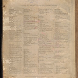
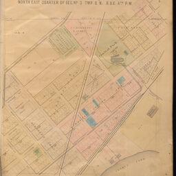
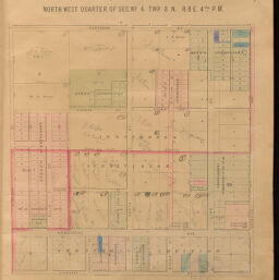
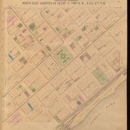
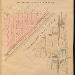
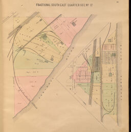
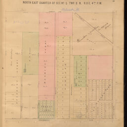
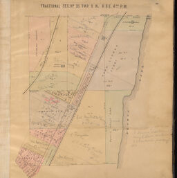
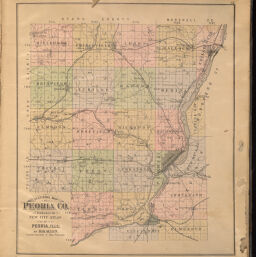
| Description | Allen's New atlas of the city and vicinity of Peoria, Illinois, compiled from plats on records and official surveys. Drawn and published by Daniel B. Allen. Relief shown by hachures.; "Copyright secured by Daniel B. Allen, 1888." Index to additions and subdivisions on inside front cover. "Sectional map" (map page index) on title page. |
| Extent | 32 leaves |
| Dimensions | 43 cm |
| Language | English |
| Publisher | Allen, Daniel B. |
| Geographic Subject | Peoria (Ill.) |
| Collection Title | Historic Illinois County Atlases |
| Rights | No Copyright - United States |
| Repository | Illinois History and Lincoln Collections |
| Type | Cartographic material |
| Bibliographic Identifier | 933708712205899 |
| Local barcode | 30112031877555 |
| Collection | Historic Illinois County Atlases |
Download Options
|
2 | |
|
3 | |

|
4 | |

|
5 | |
|
6 | |

|
7 | |

|
8 | |
|
9 | |

|
10 | |

|
11 | |

|
12 | |
|
13 | |

|
14 | |
|
15 | |
|
16 | |
|
17 | |
|
18 | |

|
19 | |
|
20 | |
|
21 | |

|
22 | |

|
23 | |

|
24 | |
|
25 | |

|
26 | |

|
27 | |

|
28 | |
|
29 | |

|
30 | |
|
31 | |
|
32 | |

|
33 | |

|
34 | |

|
35 | |

|
36 | |
|
37 | |
|
38 | |

|
39 | |
|
40 | |

|
41 | |
|
42 | |

|
43 | |

|
44 | |
|
45 | |

|
46 | |

|
47 | |

|
48 | |

|
49 | |
|
50 | |

|
51 | |
|
52 | |

|
53 | |
|
54 | |

|
55 | |
|
56 | |
|
57 | |

|
58 | |

|
59 | |

|
60 | |

|
61 | |
|
62 | |

|
63 | |

|
64 | |

|
65 | |
|
66 | |
|
67 | |
|
68 | |

|
69 |
Contact us
for questions and to provide feedback.