
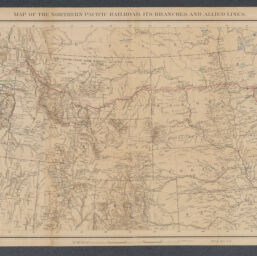
Map of the Northern Pacific Railroad, its branches and allied lines
Permalink
https://digital.library.illinois.edu/items/b06d1780-b51d-013a-c3e8-02d0d7bfd6e4-c
No Copyright - United States
Descriptive Information
| Title | Map of the Northern Pacific Railroad, its branches and allied lines |
| Creator | Northern Pacific Railroad Company |
| Scale | Scale approximately 1:5,000,000 |
| Coordinates | W 126°--W 84°/N 49°--N 38° |
| Place of Publication | St. Paul (Minn.) |
| Publisher | Julius Bien & Co. |
| Date of Publication | 1880 |
| Extent | 1 map : hand color |
| Dimensions | 30 x 69 cm |
| Notes |
|
| Coverage-Spatial | United States |
| Language | English |
| Subject | Railroads |
| Genre | Maps |
| Rights | No Copyright - United States |
| Type | Cartographic material |
| Repository | Map Library |
| Local Bib ID | 99162172712205899 |
| Collection Title | Railroad Maps |
| Collection | Railroad Maps |
Download Options
|
Map of the Northern Pacific Railroad, its branches and allied lines |
Contact us
for questions and to provide feedback.