
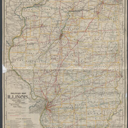
Railroad map of Illinois / prepared under the direction of, and presented by Orville F. Berry, D.A. Eckhart, Jas. A. Willoughby, Railroad and Warehouse Commissioners ; Wm. Kilpatrick, secretary ; Frank G. Ewald, consulting engineer
Permalink
https://digital.library.illinois.edu/items/b087ef10-b51d-013a-c3e8-02d0d7bfd6e4-0
No Copyright - United States
Descriptive Information
| Title | Railroad map of Illinois / prepared under the direction of, and presented by Orville F. Berry, D.A. Eckhart, Jas. A. Willoughby, Railroad and Warehouse Commissioners ; Wm. Kilpatrick, secretary ; Frank G. Ewald, consulting engineer |
| Creator | George F. Cram Company |
| Contributor | Illinois. Railroad and Warehouse Commission |
| Scale | Scale 1:506,880. 1 in. to 8 miles |
| Coordinates | (W 91°30ʹ--W 87°30ʹ/N 42°30ʹ--N 37°00ʹ) |
| Place of Publication | Chicago (Ill.) |
| Publisher | George F. Cram Company |
| Date of Publication | 1913 |
| Extent | 1 map : color, mounted on linen |
| Dimensions | 125 x 71 cm |
| Notes |
|
| Coverage-Spatial | Illinois |
| Language | English |
| Subject | Railroads |
| Genre | Maps |
| Rights | No Copyright - United States |
| Type | Cartographic material |
| Repository | Map Library |
| Local Bib ID | 99162320712205899 |
| Collection Title | Railroad Maps |
| Collection | Railroad Maps |
Download Options
|
99162320712205899-00000001 | |

|
99162320712205899-00000002 |
Contact us
for questions and to provide feedback.