
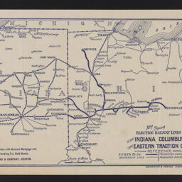
Map showing electric railway lines of the Indiana Columbus and Eastern Traction Co.
Map showing electric railway lines of the Indiana Columbus and Eastern Traction Company
Permalink
https://digital.library.illinois.edu/items/b12d26b0-b51d-013a-c3e8-02d0d7bfd6e4-c
No Copyright - United States
Descriptive Information
| Title | Map showing electric railway lines of the Indiana Columbus and Eastern Traction Co. |
| Alternative Title | Map showing electric railway lines of the Indiana Columbus and Eastern Traction Company |
| Creator | Sanderson & Porter, Inc. |
| Contributor | Hence, E. |
| Scale | Scale approximately 1:1,900,000 |
| Place of Publication | New York (N.Y.) |
| Publisher | Sanderson & Porter, Inc. |
| Date of Publication | 1920 |
| Extent | 1 map |
| Dimensions | 19 x 32 cm |
| Notes |
|
| Coverage-Spatial | Ohio |
| Language | English |
| Subject | Electric railroads |
| Genre | Maps |
| Rights | No Copyright - United States |
| Type | Cartographic material |
| Repository | Map Library |
| Local Bib ID | 99954879505905899 |
| Collection Title | Railroad Maps |
| Collection | Railroad Maps |
Download Options
|
Map showing electric railway lines of the Indiana Columbus and Eastern Traction Co. |
Contact us
for questions and to provide feedback.