
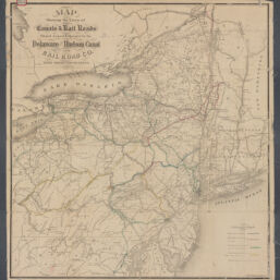
Map showing the lines of canals & rail roads owned, leased & operated by the Delaware and Hudson Canal and Rail Road Co., with their connections
Permalink
https://digital.library.illinois.edu/items/b14019d0-b51d-013a-c3e8-02d0d7bfd6e4-d
No Copyright - United States
Descriptive Information
| Title | Map showing the lines of canals & rail roads owned, leased & operated by the Delaware and Hudson Canal and Rail Road Co., with their connections |
| Creator | Delaware and Hudson Canal Company |
| Scale | Scale not given |
| Place of Publication | Albany (N.Y.) |
| Publisher | Weed, Parsons & Co. |
| Date of Publication | 1857 |
| Extent | 1 map : hand color |
| Dimensions | 76 x 71 cm |
| Notes |
|
| Coverage-Spatial | New York (State) |
| Language | English |
| Subject | Canals |
| Genre | Maps |
| Rights | No Copyright - United States |
| Type | Cartographic material |
| Repository | Map Library |
| Local Bib ID | 99955091461405899 |
| Collection Title | Railroad Maps |
| Collection | Railroad Maps |
Download Options
|
Map showing the lines of canals & rail roads owned, leased & operated by the Delaware and Hudson Canal and Rail Road Co., with their connections |
Contact us
for questions and to provide feedback.