
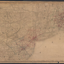
Rand, McNally & Co.'s railroad investment map of the United States
Railroad investment map of the United States
Permalink
https://digital.library.illinois.edu/items/b14be5f0-b51d-013a-c3e8-02d0d7bfd6e4-0
No Copyright - United States
Descriptive Information
| Title | Rand, McNally & Co.'s railroad investment map of the United States |
| Alternative Title | Railroad investment map of the United States |
| Creator | Rand McNally and Company |
| Scale | Scale 1:506,880. 8 miles = 1 inch |
| Coordinates | (W 79°00ʹ--W 69°30ʹ/N 43°30ʹ--N 39°00ʹ) |
| Place of Publication | Chicago (Ill.) |
| Publisher | Rand McNally and Company |
| Date of Publication | 1908 |
| Extent | 1 map : hand color, mounted on fabric |
| Dimensions | 98 x 156 cm |
| Notes |
|
| Coverage-Spatial | |
| Language | English |
| Subject | Railroads |
| Genre | |
| Rights | No Copyright - United States |
| Type | Cartographic material |
| Repository | Map Library |
| Local Bib ID | 99955096593905899 |
| Collection Title | Railroad Maps |
| Collection | Railroad Maps |
Download Options
|
Rand, McNally & Co.'s railroad investment map of the United States |
Contact us
for questions and to provide feedback.