


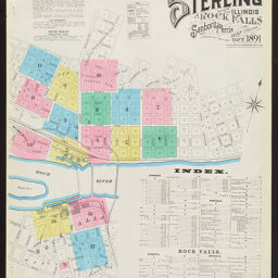
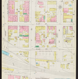
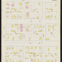
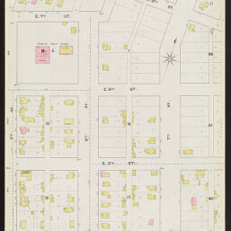
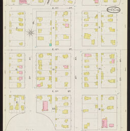
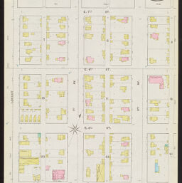
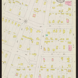
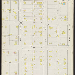
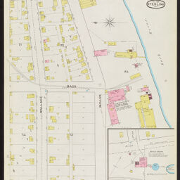
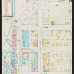
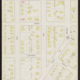
Sterling and Rock Falls, Whiteside County, Illinois, Oct. 1891
Permalink
https://digital.library.illinois.edu/items/c23ea180-c451-0133-1d17-0050569601ca-d
In the public domain.
Descriptive Information
| Title | Sterling and Rock Falls, Whiteside County, Illinois, Oct. 1891 |
| Creator | Sanborn-Perris Map Co. |
| Coverage-Spatial | Rock Falls (Ill.) |
| Genre | Fire insurance maps |
| Subject | Fire insurance |
| Publisher | Sanborn-Perris Map Co. |
| Date of Publication | 1891 |
| Place of Publication | New York (N.Y.) |
| Scale | Scale ca. 1:600. |
| Language | English |
| Notes |
|
| Extent | 17 maps : color |
| Dimensions | 64 x 54 cm |
| Coordinates | (W 89⁰41ʹ46ʺ/N 41⁰47ʹ19ʺ) |
| Rights | No Copyright - United States |
| Rights Description | In the public domain. |
| Type | Cartographic material |
| Repository | Map Library |
| Local Bib ID | 1613881 |
| Collection Title | Sanborn Fire Insurance Maps |
| Collection | Sanborn Fire Insurance Maps |
Download Options
|
1891_Page001 | |

|
1891_Page002 | |

|
1891_Page003 | |
|
1891_Page004 | |

|
1891_Page005 | |
|
1891_Page006 | |
|
1891_Page007 | |
|
1891_Page008 | |
|
1891_Page009 | |
|
1891_Page010 | |

|
1891_Page011 | |
|
1891_Page012 | |

|
1891_Page013 | |
|
1891_Page014 | |
|
1891_Page015 | |

|
1891_Page016 | |
|
1891_Page017 |
Contact us
for questions and to provide feedback.