


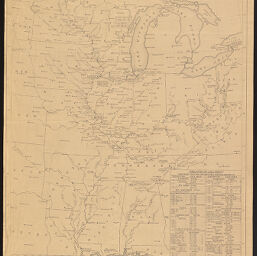
Principal rivers in central portion of the United States. Location & sizes of locks
Permalink
https://digital.library.illinois.edu/items/c89473c0-66e4-0138-727b-02d0d7bfd6e4-d
No Copyright - United States
Descriptive Information
| Title | Principal rivers in central portion of the United States. Location & sizes of locks |
| Creator | United States. Army. Corps of Engineers |
| Contributor | United States. Army. Corps of Engineers. Upper Mississippi Valley Division |
| Scale | approximately 1:2,534,400. 1 in. = 40 miles |
| Place of Publication | Saint Louis (Mo.) |
| Publisher | United States. Army. Corps of Engineers. Upper Mississippi Valley Division |
| Date of Publication | 1946 |
| Extent | 1 map |
| Notes |
|
| Coverage-Spatial | Mississippi River Valley |
| Language | English |
| Subject | |
| Genre | |
| Rights | No Copyright - United States |
| Type | Cartographic material |
| Repository | Map Library |
| Local Bib ID | 3992319 |
| Collection Title | River Maps |
| Collection | River Maps |
Download Options
|
Principal rivers in central portion of the United States. Location & sizes of locks |
Contact us
for questions and to provide feedback.