


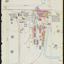
Insurance maps of East St. Louis, Illinois. Volume 1, sheet 89
Monsanto Chemical Works, commercial acid plant
Permalink
https://digital.library.illinois.edu/items/c8c462f0-c451-0133-1d17-0050569601ca-7
In the public domain.
Descriptive Information
| Title | Insurance maps of East St. Louis, Illinois. Volume 1, sheet 89 |
| Alternative Title | Monsanto Chemical Works, commercial acid plant |
| Creator | Sanborn Map Company |
| Coverage-Spatial | East Saint Louis (Ill.) |
| Genre | Fire insurance maps |
| Subject | Fire risk assessment |
| Publisher | Sanborn Map & Publishing Co. |
| Date of Publication | 1919 |
| Place of Publication | New York (N.Y.) |
| Scale | Scale 1:1,200. 100 ft. to 1 in. |
| Language | English |
| Notes |
|
| Extent | 1 map : color |
| Dimensions | 65 x 55 cm |
| Rights | No Copyright - United States |
| Rights Description | In the public domain. |
| Type | Cartographic material |
| Repository | Map Library |
| Local Bib ID | 6713847 |
| Collection Title | Sanborn Fire Insurance Maps |
| Collection | Sanborn Fire Insurance Maps |
Download Options
|
Insurance maps of East St. Louis, Illinois. Volume 1, sheet 89 |
Contact us
for questions and to provide feedback.