
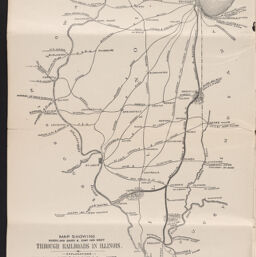
Map showing north and south & east and west through railroads in Illinois
Map showing north and south and east and west through railroads in Illinois
Permalink
https://digital.library.illinois.edu/items/e1170fb0-2581-013b-c7b0-02d0d7bfd6e4-b
No Copyright - United States
Descriptive Information
| Title | Map showing north and south & east and west through railroads in Illinois |
| Alternative Title | Map showing north and south and east and west through railroads in Illinois |
| Creator | Danville, Olney and Ohio River Railroad Company |
| Scale | Scale 1:2,534,400. 40 [miles] to 1 inch |
| Place of Publication |
|
| Publisher | Danville, Olney and Ohio River Railroad Company |
| Date of Publication | 1881 |
| Extent | 1 map |
| Dimensions | 27 x 19 cm, on sheet 34 x 43 cm |
| Notes |
|
| Coverage-Spatial | Illinois |
| Language | English |
| Subject | |
| Genre | Maps |
| Rights | No Copyright - United States |
| Type | Cartographic material |
| Repository | Map Library |
| Local Bib ID | 99955201823205899 |
| Collection Title | Railroad Maps |
| Collection | Railroad Maps |
Download Options
|
Map showing north and south & east and west through railroads in Illinois |
Contact us
for questions and to provide feedback.